Chasing mornings on the Caney Fork or quiet evenings by the Collins River? If you’re considering a river or lake property in Rock Island, TN 38581, you’re in good company. Buyers come here for scenic water, wooded bluffs, and easy access to Rock Island State Park. In this guide, you’ll learn how to evaluate a waterfront or water-adjacent parcel, what permits and inspections to expect, and how Rock Island compares to big Upper Cumberland lakes. Let’s dive in.
Why Rock Island appeals
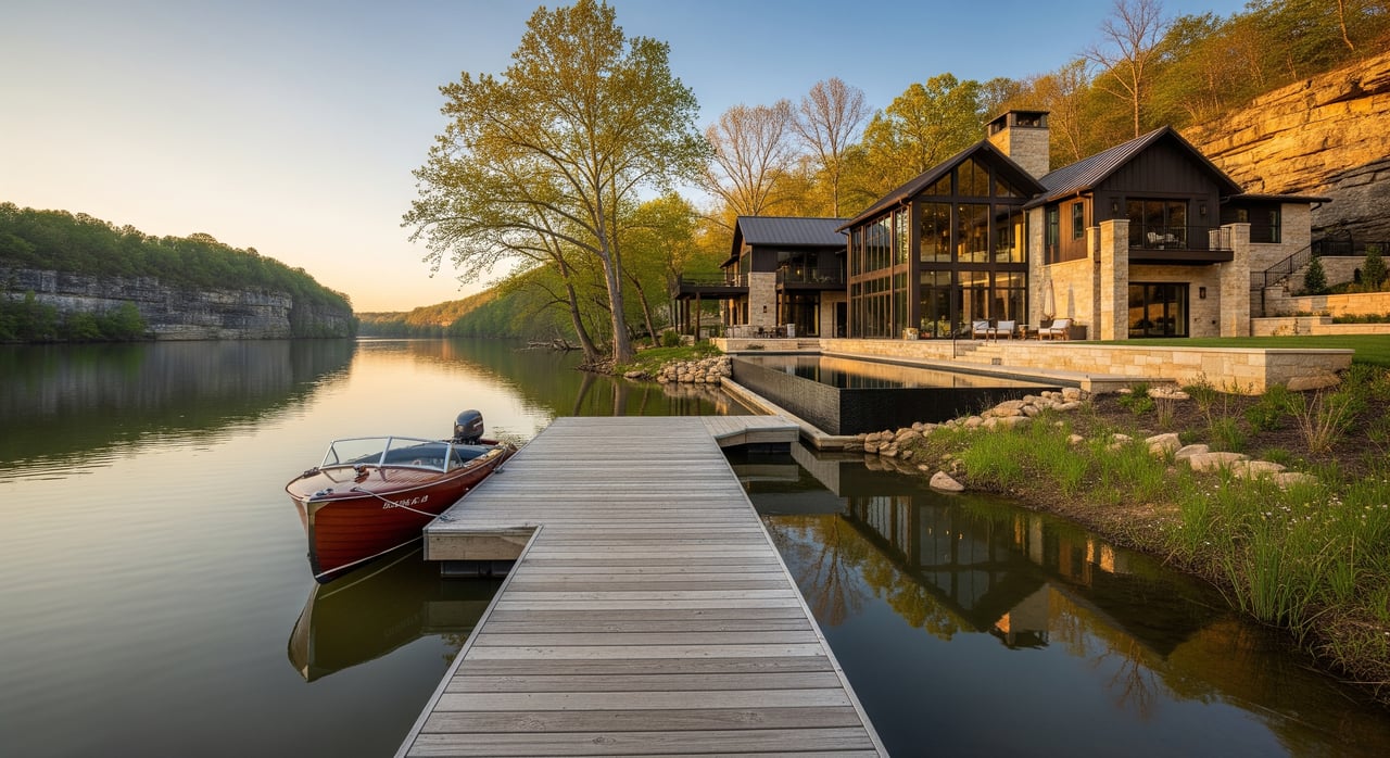
Rock Island sits along the Caney Fork and Collins River corridor in Warren County. The setting is river-forward with short floats, paddling, fishing, and dramatic waterfalls inside Rock Island State Park. If you like trail time, fishing access, and scenic water over marina life, this area fits well.
You’re also within an hour or two of larger reservoirs like Center Hill or Dale Hollow, which offer bigger-water boating and marinas. Many buyers choose Rock Island for the river lifestyle and use the larger lakes for occasional day trips.
River vs. lake lifestyle
Recreation and vibe
- Rock Island and the Caney Fork/Collins corridor focus on paddling, tubing, bank fishing, and short river floats with state park access points.
- Center Hill, Dale Hollow, and other Upper Cumberland reservoirs lean into marinas, powerboating, and broad shoreline recreation.
Parcel patterns
- Near the park, you’ll find pockets of small riverfront lots for cabins or weekend cottages.
- A short drive away, larger wooded tracts are common and can suit second homes, hobby recreation, or future builds.
What to evaluate on a waterfront lot
Topography, soils, and geology
Terrain varies from river benches to steep bluffs and ridgelines. Central Tennessee also has common limestone and karst features, which can include sinkholes. Ask about any sinkhole or drainage history. On steep or bluff sites, a geotechnical review is wise to assess slope stability and foundation options.
Active river flows can erode banks over time. If you see older riprap or retaining walls, plan for potential repair costs. Stabilization work often requires permits from state agencies.
Flood, inundation, and seasonal flows
Riverfront properties may lie in FEMA 100-year or 500-year flood zones. Flood zones can affect insurance and building options. Check the FEMA Flood Map Service Center for a parcel’s zone and request any existing elevation certificates.
Seasonal flows matter. Spring runoff or storm events can raise water levels and change access. Some sections may have temporary high-flow conditions that limit hand-carry launches.
Access and easements
- Road access can be public, private, or via a recorded easement across neighboring land. Confirm that private roads have maintenance agreements and are passable year-round.
- Water access differs by parcel. Some lots have only footpaths, while others include a shared ramp or drive-down access. Clarify any shared facility rules or fees in writing.
Utilities and services
- Water: Many rural river properties rely on private wells. Plan to test for bacteria, nitrates, and general water quality.
- Sewage: Most sites use on-site septic systems. Confirm current permits and capacity, or order a soil and site evaluation for a new system.
- Power and communications: Electricity is usually available through a local provider fed by TVA power. Internet and cell service vary by location, so verify providers and speeds at the address.
- Services: Trash collection may be limited, and emergency access can take longer on private roads. Factor this into your plans, especially for short-term stays.
Permits and rules you should know
Riparian rights and who owns what
Riparian rights can differ by waterway and whether the river is considered navigable. Title often runs to the mean or ordinary high-water mark, while submerged lands below navigable rivers may be state-owned. Review the deed for any language on water access, docks, or exclusive bank rights, and consult an attorney for title or riparian questions.
Building, setbacks, and shoreline work
Warren County Planning and Zoning sets local rules for setbacks and uses. Shoreline or in-water work, including docks, bank stabilization, or fill below the high-water mark, may require permits from the Tennessee Department of Environment and Conservation. Start with TDEC water resource permits to understand requirements.
If you are considering a reservoir property like Center Hill, the Tennessee Valley Authority oversees shoreline use and structures. Review TVA shoreline management before planning docks or vegetation changes on TVA-managed waters.
Septic and wells
The Warren County Health Department issues septic permits and reviews soil evaluations for absorption fields. Private wells should be installed by licensed contractors and tested for quality. TDEC offers additional guidance on wastewater and groundwater standards at TDEC’s environment portal.
Flood insurance and lending
If a structure sits in a high-risk flood zone, many lenders require flood insurance. Ask your lender for a preliminary flood determination and review the FEMA flood map for your site. Premiums, coverage options, and build decisions often hinge on the elevation certificate.
Fishing, boating, and safety rules
Before you fish or launch, check TWRA fishing regulations and boating rules for seasons, stocking, and equipment requirements. TWRA also covers boat registration for Tennessee waters.
Your due diligence checklist
Use this list as a starting point and tailor it to the parcel:
- Title and deed review for access, riparian rights, and any restrictive covenants or conservation easements.
- Boundary survey to confirm lines and any encroachments near the water.
- Topographic survey if you plan to build, site a septic field, or assess bluff stability.
- Flood zone lookup at the FEMA Flood Map Service Center and request any elevation certificates.
- Septic system inspection by a licensed professional; soil and site evaluation for new systems with the county health department.
- Well testing for coliform bacteria, nitrates, pH, hardness, and local minerals if a well exists.
- Geotechnical review for steep banks or bluffs to assess stability and drainage planning.
- Environmental and wetland screening, especially for larger tracts or unusual habitats. Start with TDEC environmental guidance and consult agencies as needed.
- Utility verification for power, internet, and potential extension costs.
- Early permit check with Warren County Planning and Zoning and TDEC for any planned shoreline or in-water work.
Rock Island vs. big Upper Cumberland lakes
If you are comparing riverfront in Rock Island to lakefront on Center Hill or Dale Hollow, weigh your priorities.
- Recreation: Rock Island is about river scenery and short trips to waterfalls and rapids. The big lakes prioritize large-surface boating and marinas.
- Development: Rock Island has a river-cottage feel near the park, plus larger wooded tracts nearby. Lakefront areas often include more subdivisions and shoreline amenities.
- Oversight: Riverfront work typically runs through TDEC and federal wetland rules, while TVA or the U.S. Army Corps of Engineers apply structured shoreline programs on reservoirs like Center Hill or Dale Hollow. Both require permits, but agency oversight and timelines differ.
Smart steps before you write an offer
- Walk the property line and the water’s edge. Note bank stability, access paths, and any existing structures.
- Pull the flood map and check the building envelope against setbacks and elevations.
- Confirm utility access and plan for well and septic testing.
- Review riparian language in the deed and any shared-use agreements for ramps, roads, or docks.
- Talk with TDEC early if you are considering bank work, a dock, or any in-water construction.
- Order the right inspections. A standard home inspection is step one for existing structures, but riverside parcels often call for septic, water, geotechnical, and topo surveys too.
How a local expert helps
A knowledgeable local agent can save you time and risk by coordinating the right steps at the right time. You should expect help with:
- Reading easements, road maintenance agreements, and riparian clauses.
- Sourcing licensed surveyors, septic pros, well drillers, and geotechnical engineers.
- Pre-checking permit paths with TDEC and, if applicable, TVA for docks or stabilization.
- Comparing riverfront vs. lakefront comps across the Upper Cumberland.
- Managing due diligence for remote buyers who need boots-on-the-ground support.
Ready to explore river or lake property in Rock Island 38581 with a clear plan and local guidance? Reach out to Robbie Porter for patient, step-by-step support and vetted local resources.
FAQs
What makes Rock Island river property different from Center Hill Lake?
- Rock Island centers on river recreation and park access, while Center Hill Lake offers marina services and large-water boating under TVA shoreline rules.
How do I check if a Rock Island property is in a flood zone?
- Look up the address on the FEMA Flood Map Service Center and request any elevation certificates for structures.
Can I build a dock or stabilize the bank on the Caney Fork or Collins River?
- Many in-water or bank projects require permits from TDEC, and reservoir sites may involve TVA shoreline management.
Who handles septic permits for properties in Warren County, TN?
- The Warren County Health Department issues septic permits and reviews soil and site evaluations for on-site systems.
What inspections are essential for riverfront land near Rock Island State Park?
- Prioritize a boundary and topo survey, septic inspection and soil test, well testing, flood zone and elevation review, and a geotechnical assessment for steep banks.
Where can I confirm fishing seasons and boat rules in the Rock Island area?
- Check TWRA fishing regulations and boating information for current seasons, licensing, and safety requirements.